


*Agency Maps 85,325 Sq Km Seabed.
By Helen Udo.
In a landmark move to harness the economic potential of its maritime domain, the National Hydrographic Agency (NHA) has announced that Nigeria could generate up to $10 million in annual revenue through the full deployment of locally produced electronic navigational charts across its territorial waters.
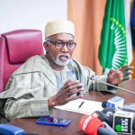
The disclosure was made by Rear Admiral Ayo Olugbode, Hydrographer of the Federation, during a media briefing held in Abuja ahead of the 2025 World Hydrography Day celebration.
According to Admiral Olugbode, Nigeria has already begun earning revenue through subscriptions paid by vessels accessing Nigerian waters via the country’s indigenous electronic charts, which are part of the Electronic Navigational Chart Information System (ENCIS). These charts are vital tools for ensuring safe and efficient marine navigation, especially for commercial shipping.
“Right now, we’ve started receiving revenues from ships making port calls in Nigerian waters who subscribe to our charts. It works like a digital subscription model — and the more charts we complete, the more value we can derive,” Olugbode stated.
With the global market for electronic navigational charts valued at approximately $90 million annually, Olugbode noted that Nigeria’s projected share, once it completes full seabed mapping and chart production, could reach between $9 million and $10 million each year.
But beyond economic gains, the Hydrographer emphasized that hydrography plays a far broader role in national development. He highlighted the agency’s ongoing efforts to support sectors such as fisheries, aquaculture, recreational navigation, environmental protection, and coastal infrastructure planning.
The agency has already partnered with boat owners, fishing clubs, and aquaculture businesses to develop customized charts that ensure safe operations at sea. In addition, coastal states are being provided with hydrographic data to guide sustainable infrastructure projects and support climate-resilient development.
“Our work enables safer shipping, reduced insurance costs, better fisheries management, and smarter coastal development,” Olugbode explained. “We are building a future where hydrography doesn’t just guide ships — it powers economies.”
In alignment with the United Nations-endorsed Seabed 2030 initiative — a global effort to map the entire ocean floor by 2030 — Nigeria has made a significant contribution by surveying and submitting 85,325 square kilometers of seabed data to the global database.
Olugbode reiterated that Nigeria’s hydrographic mission is regional in scope, extending beyond its borders to neighboring West African countries. “Hydrography is a shared responsibility,” he said. “We are not just mapping Nigeria’s waters — we are enabling neighboring countries to benefit from our tools, expertise, and data to enhance maritime safety and stimulate the blue economy.”
In support of this regional effort, Nigeria has committed to providing survey vessels, personnel training, and access to bathymetric data to other West African nations. These efforts are aimed at fostering maritime safety, improving navigation, and unlocking economic potential across the Gulf of Guinea.
The Hydrographer further revealed that over 200 personnel have been trained under the agency’s development programs, with increasing female participation under the global Women in Hydrography initiative. Nonetheless, he noted that only about 15% of the required workforce currently meets international standards, calling for greater investment in capacity building.
As part of efforts to boost hydrographic awareness and cooperation, Nigeria will host the upcoming West African Hydrographic Summit and the 2025 World Hydrography Day celebrations in Abuja.
The event is expected to convene regional leaders, maritime stakeholders, technical experts, and international development partners to strengthen collaboration and chart the future of hydrography in the subregion.